
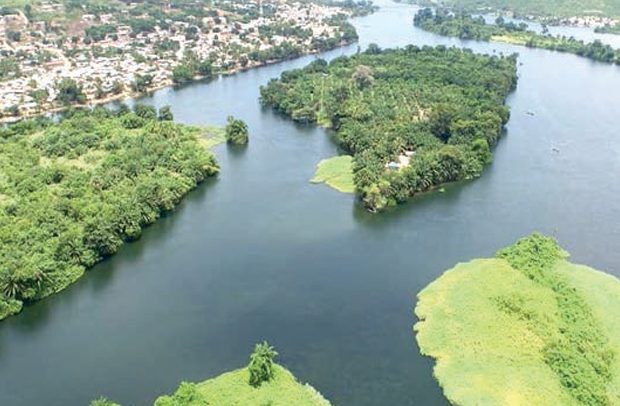
A view of the Volta River
Ghana is, indeed, endowed with different unique water bodies just as its awe-inspiring mountains, epic road trips, enormous national parks, monuments, beautiful waterfalls, sceneries and night life.
The sheer diversity of Ghana’s climate and geography has created some of the most unique rivers. Today, NEWS-ONE brings to tourists who are visiting Ghana some of beautiful rivers they may want to see while in town.
This is part of an initiative by the office of the Ministry of Tourism Arts & Culture to guide tourists to the best experiences in Ghana.
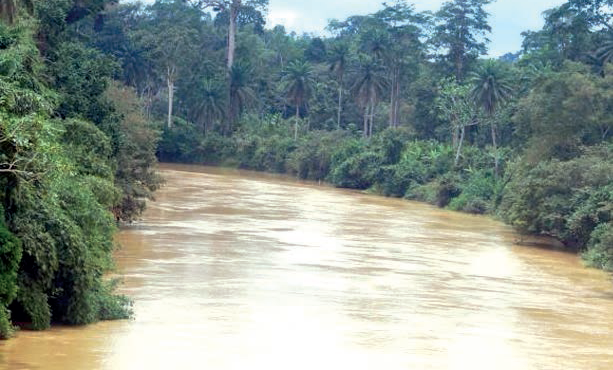
Tano River
The Tano River is the fifth longest river in Ghana, having a total length of 249 miles (400 kilometers). The river starts near the town of Techiman and then flows through the Ehy Lagoon and the Tendo Lagoon. The river then enters the neighbouring Côte d’Ivoire and flows through the Aby Lagoon before it finally reaches its mouth at the Atlantic Ocean.
The river is mostly in Ghana as only the last few kilometers of the river are along the Ghana-Côte d’Ivoire international land boundary before crossing into Côte d’Ivoire for the rest of its smaller stretch. Local indigenous beliefs of the Akan people who make up the majority ethnic group in both Ghana and Côte d’Ivoire believe that the highest Akan god, Taakora, lives at the source of the Tano River.
Oti (Pendjari) River
The Oti River, also called the Pendjari River, is the fourth longest river in the country, having a total length of 323 miles (520 kilometers). The source of the Oti River starts in Burkina Faso from a tributary of the Volta River and then flows through Benin and Togo, which are east of Ghana. The river then flows into Ghana to its mouth which is in the Lake Volta reservoir. The river’s path also helps to form some of the international borders that exist between the four countries. The Oti Rivers also flows right through the Pendjari National Park in Benin that is adjoined to the Arli National Park in neighbouring Burkina Faso.
White Volta River
The White Volta River is the third longest river in the country, having a total length of 550 miles (885 kilometers). The source of the river starts north of Burkina Faso’s capital of Ouagadougou between two massifs and then takes a mostly southward path through Burkina Faso and Ghana until it reaches its mouth at the Lake Volta reservoir. The White Volta, like the other Volta River, is named so due to the many turns that it makes along its course, since Volta is the Portuguese word for twist and the Portuguese were the first Europeans to arrive in the area in 1471. There are also two main towns in Ghana (Daboya and Yapei) that sit on the White Volta.
Black Volta River
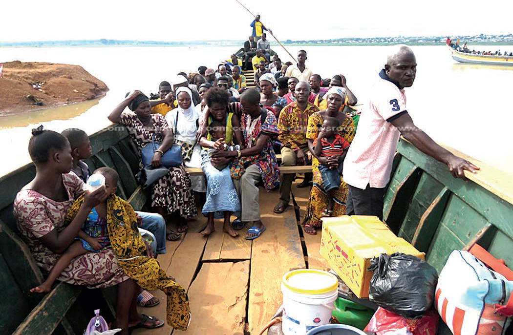
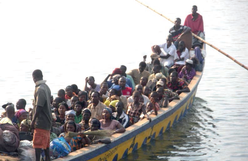
The Black Volta River is the second longest river in the country, being a total length of 840 miles (1,352 kilometers). The source of the Black Volta starts in Burkina Faso and then flows north and east until it turns southwards to form the border between Ghana and Burkina Faso and later the border between Ghana and Côte d’Ivoire. At this point when the river reaches the town of Bamboi in Ghana, it then flows north and later east until it finally reaches its mouth at Lake Volta reservoir. The major towns that sit on the river in Ghana are Lawra and Bamboi, the latter of which has ferry services to use on the river. In 2013, the Bui Dam was built on the Black Volta at the Bui Gorge, near the border with Côte d’Ivoire and it is currently the second largest hydroelectric generating plant in Ghana.
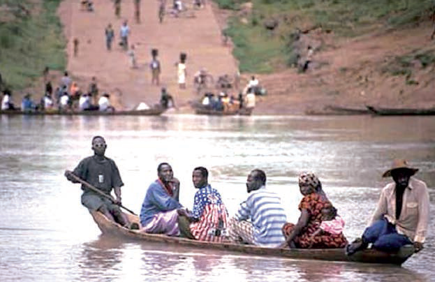
Volta River
The Volta River is the longest river in the country and also by far the longest river that is completely in Ghana, being a total length of 994 miles (1,599 kilometers). The Volta River formed at the point where the headstreams of the Black Volta and the White Volta meet. From this point it flow south through the country, goes through Lake Volta, and then it finally reaches its mouth by discharging into the Atlantic Ocean at the Gulf of Guniea between the Keta Lagoon Protected Area and the Songor Lagoon Protected Area. Lake Volta, where the Volta River goes through, is one of the largest artificial lakes in the world, having been formed in 1965 with the completion of the Akosombo Dam. The reservoir at this dam helps to generate electricity to the people of Ghana via the Volta River Authority and help to provide a route for inland water transport.
Ankobra River
The Ankobra River is situated in Ghana, rising North East of Wiawso. It flows about 190 kilometres (120 m) south to the Gulf of Guinea.
It belongs to the Western River System and covers an area of about 8,460 km2. The river takes its source from the hills north of Basin dare near Bibiani and flows for about 260 km mostly south before it enters the Gulf of Guinea at Asanta a few kilometres west of Axim.
Densu River
The Densu River takes its source from the Atewa range and flows from its upstream sections in an easterly direction towards the Akwadum-Koforidua area, from where the river gradually changes its course and flows in a southerly direction into the Weija reservoir – one of the two main sources of water supply for the Accra metropolitan area. When the Weija reservoir is full excess flow discharges into the Densu Delta (Sakumo) lagoon and salt pans complex, which constitutes one of Ghana’s internationally recognized protected areas (Ramsar sites) before discharging into the Bay of Guinea (Atlantic Ocean) some 10 km west of Accra. The Densu River belongs to the Coastal River System group and the basin encompasses an area of about 2,600 km2. The total length of the Densu River is about 120 km, and its main tributaries are the Pompon, Kuia, Adeiso, Dobro and Nsaki rivers.
River Pra
The Pra Basin is located south-central Ghana. The Pra River, together with its tributaries, form the largest river basin of the three principal south-western basins systems of Ghana (i.e. Ankobra, Tano and Pra). Its total basin area of approximately 23,200 km² extends through almost 55 per cent of Ashanti, 23 per cent of Eastern, 15 per cent of Central and seven per cent Western Regions. The main Pra River and its major tributaries–(Rivers Anum, Birim, Offin and Oda), takes its source from the highlands of Kwahu Plateau in the Eastern Region and flows for some 240km before entering the Gulf of Guinea, near Shama in the Western Region.