
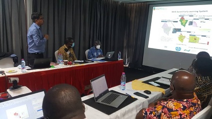
Mr. Ramesh Tripathi, Project Manager of the Volta Basin Flood and Drought Management addressing participants.
A three-day capacity building workshop on the development of flood and drought risk maps in the Volta Basin has been held in Accra.
The flood and drought maps, when developed, should help the countries to have decision tools on the menace of floods and droughts in a multi-dimensional perspective.
The workshop was part of the activities of the project “Integrating Flood and Drought Management and Early Warning for Climate Change Adaptation (VFDM) in the Volta Basin» funded by the Adaptation Fund.
The project was organised by the World Meteorological Organisation (WMO), a specialised agency of the United Nations, the Volta Basin Authority (ABV) and the Global Water Partnership in West Africa (GWP-WA).
Mr Ramesh Tripathi, Project Manager of the Volta Basin Flood and Drought Management Project said the objective of the workshop is to develop the knowledge necessary for the assessment of vulnerability and impact to floods and exposure to drought.
He said technicians were selected from six countries , Ghana, Benin, Burkina Faso, Ivory Coast, Mali and Togo.
Mr Tripathi said the project would enable the technicians to improve their understanding on important concepts of risk assessment such as exposure, vulnerability and impact for floods and droughts.
“We have brought the technicians to take ownership of the methodological approach for the evaluation of drought exposure, as well as flood impact, with a scenario-based approach, produce flood impact maps, according to the scenario-based approach, and drought exposure maps,” he said.
Mr Tripathi said the technicians would be expected to ensure they update risk map regularly with new information which would be available at local and national level.
“This activity is to ensure that after the project they have the knowledge and skills to update this risk map because risk map is something which keeps changing in every or five years 10,” he said.
He said they would also develop drought exposure and flood impact maps for each national portion of the basin from their respective countries.
The Executive Secretary, Water Resources Commission, Mr Ben Ampomah, commended the organisers of the project and said it would go a long way in helping solve flood related issues.
“Technicians would to follow flood and drought maps and basically, these maps help us united district level to plan,” he said.
Anna Mapelli, a Hydrologist from CIMA Research Foundation said her outfit would continue to provide technical Support to the technicians either through face to face or online platform approach.
Ms Charlotte Acheampong, Director for climate Change Adaptation and Disaster risk reduction at NADMO said early warning system was necessary in tackling flood issues.
“it is going to support us in our work at the end of the day if you are able to get any information then it means early response which would lead to less or no loss of life,” she said.
She said there was the need to coordinate and bring on board other projects that were o going or done already and synchronize everything in order to have a one stop shop for the needed information.
” Once you have the information you begin to get historical data and then plan policy wise in building a resilient country,” she added.
By Linda Tenya-Ayettey